Most information presented below is courtesy of Arne Bartels using 'Chronik des Flugplatzes Zwischenahn' as the main source, and Bernhard Weiss (see his Fliegerhorste site). Also, Manfred Tegge has a great page about Bad Zwischenahn on his Relikte in Niedersachsen und Bremen site.
Bad Zwischenahn was established in 1937 as a civil airport (grass runway) and seaport (using the Bad Zwischenahner See). It was taken over by the Luftwaffe in 1939. Reconstruction and extension up to 1940. Three asphalt runways were constructed, and hangars erected. The following units were stationed here:
In the book 'The Last Year of the Luftwaffe: May 1944 to May 1945' by Alfred Price it is reported that III/KG3 used Bad Zwischenahn to air-launch Fi 103's (V-1's) after the ground launching sites in France were lost. Other bases used for air-launching were Gilze-Rijen and Venlo in the Netherlands and Beauvais in France.
Bad Zwischenahn was first bombed on 30 May 1944, with moderate damage. On 15 August 1944 it was attacked again, again causing moderate damage. Two bombardments on 21 and 24 March 1945 destroyed the airfield largely. It was captured by Canadian troops at the end of April 1945.
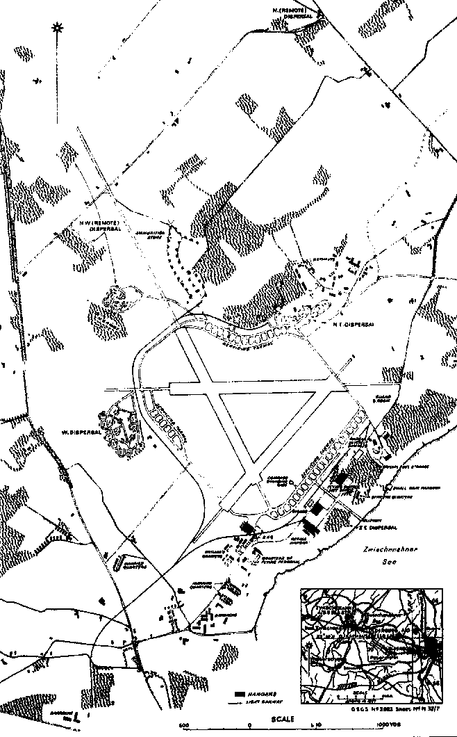
Shown below is a wartime RAF/USAF map of Bad Zwischenahn, home to EK16 until August 1944. The date of the map is unknown. Source: 'Fliegerhorste und Einsatzhäfen der Luftwaffe' by Karl Ries and Wolfgang Dierlich, Motorbuch Verlag

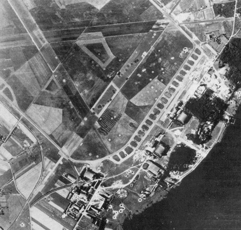
This aerial photo was taken on 2 August 1944. Source is most likely RAF.
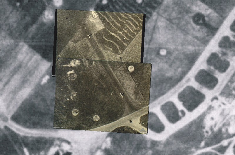
Richard Aigner found two photos in the Australian War Memorial photo database. Photo SUK13187 and photo SUK13188 show a Komet starting its take-off roll. The description reads "Zwischenahn, Germany. C. 1944-10. A Messerschmitt Me163 "Komet" liquid rocket fighter aircraft photographed during take-off at Zwischenahn with a dense light-coloured exhaust trail issuing from its tail.". The photos can be overlaid perfectly on the aerial photo shown above, and show the Komet taking of from runway 33. If you look closely, the Komet is also visible in the overall photo.
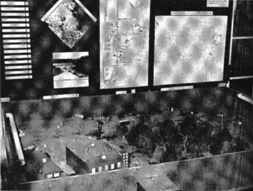
After the war all hangars and runways were blown up, and the RAF set up a hospital at the lakeside. The hospital was taken over by the German Defense (Bundeswehr) in 1959. The hospital has a model of the former airfield inside the lobby. It was built by J. Reinike, who also wrote 'Chronik des Flugplatzes Zwischenahn'. The model represents a small part of the airfield, and includes photos and drawings, visible in the background. The photo below was made in 1968, and the scan is courtesy of Lorne Hughes (Canada).
The grass area north of the the east-west runway is now a glider strip. It occupies only a small part of the former airfield. The local Luftsportverein Oldenburg - Bad Zwischenahn e.V. gliding club has a website with some photos of their strip and the former airbase. Some traces of the servicing ramps on the north side are visible in aerial photographs.
The old runways remained off-limits because of unexploded bombs, and a forrests have grown on them over the years. The north-east south-west runway has largely disappeared. The south corner was cleared in 1998 in preparation of a golf course, which will cover the majority of the former airfield. Bernhard Weiss (see his Fliegerhorste site) reported that the golf course was finished in 2001. For more information on the golf course, check out the Golfclub am Meer Bad Zwischenahn e. V. site. Furthermore a park for a national garden show is being developed on other parts.
The following pictures of the remains of the airfield were made by Arne Bartels in 1999:
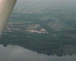
| Aerial view, clearly showing two of the three original runways overgrown with trees. The gliding airstrip can be seen north of the east-west runway (slighty right of the middle in the picture). On the south side (just left of the middle) a golf course can be seen. |
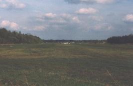
| A view of the gliding airstrip. |
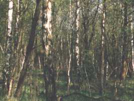
| This used to be a runway! |
Bernhard Weiss kindly sent the following photo. This is possibly the only remaining original building of Bad Zwischenahn airbase. It can be found immediately north of the Bundeswehrkrankenhaus (Military Hospital). The building served as maintenance facility, but is yet unknown what was maintained there. Only half of the building remains; the other half was destroyed during bombing raids. Surrounding the building are concrete aircraft maneuvering-areas, but they are difficult to see in the photo. The building is now used as a barn. The house to the left is a post-war addition. It appears that the original officers mess still exists, more news will follow.
Photo and copyright by Bernhard Weiss of the Fliegerhorste site
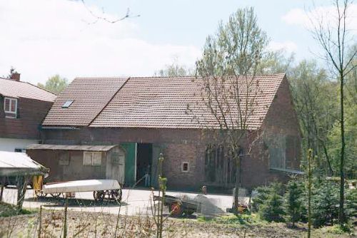
|
More Bad Zwischenahn photos were kindly supplied by N. Giese by way of Bernhard Weiss of the Fliegerhorste site.
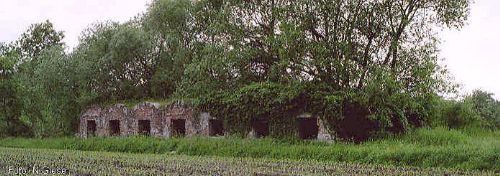 | The remains of a storage facility at Bad Zwischenahn, nicely hidden in bushes and trees Photo and copyright by N. Giese |
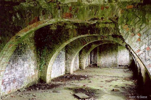
| The interior of the storage facility, which is suprisingly intact. Photo and copyright by N. Giese |